On October 9th, upon invitation of Levan Losaberidze and Mariam Eloshvili, who discovered them in 2019 during a survey, some members of the expedition paid a visit to a field of kurgans (barrow graves) in the territory of the Gardabani Village (Kvemo Kartli), took GPS points of them and prepared a first documentary dossier of them as a preliminary step for a possible joint investigation.
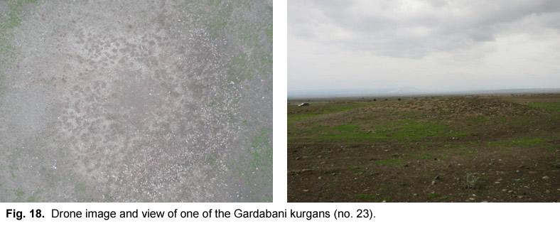
The site lies at a distance of ca 12 km to the NE of Gardabani as the crow flies, very close to the present Georgian-Azerbaijani border in a semi-desert and presently uncultivated area previously occupied by a military camp. A total of 32 kurgans of small and medium dimensions (diameter from 10 to 20 m, height between 0.50 and 1.50-2.0 m) scattered over an area of max 20 hectares, were identified and mapped. They were arranged in two main groups, consisting of 12 and 17 kurgans respectively. To judge from the satellite pictures, some of them might have been surrounded by a larger earth mound or by a on outer circle of stones of up to 40 m of diameter. Their state of preservation is apparently good: they show few evident traces of plundering, but some of them are apparently completely or partially flattened (Fig. 18).
The kurgans were covered with medium-and small-size river pebbles, apparently not very dense; under these, they mostly seem to consists of a more compact layer of grit. No ancient material was found around and on the kurgans, except for a few small obsidian fragments and, notably, an obsidian arrowhead. As for their date, the vicinity to Boyuk Kesik on the other side of the Georgian/Azerbaijani border, as well as the small dimensions, might suggest a Late Chalcolithic date; alternatively, and more probably, they might belong to the Late Middle/(Early?) Late Bronze Age. In any case, they are very interesting because of their very number and apparent good state of preservation.