During the 2018 season we recorded sites identified on satellite imagery, maps, published literature and those known to local archaeologists and residents. However, we were unable to undertake much systematic survey due to heavy ground cover. In the summer, most of the fields in the area were still under crop or only recently harvested, but not yet ploughed. Visibility was very poor and it is therefore likely that sites consisting only of low mounding or artefact scatters were hard to identify.
The timing of the 2019 season was meant to coincide with the period after the fields had been ploughed. In general, this was the case and ground visibility was better overall.
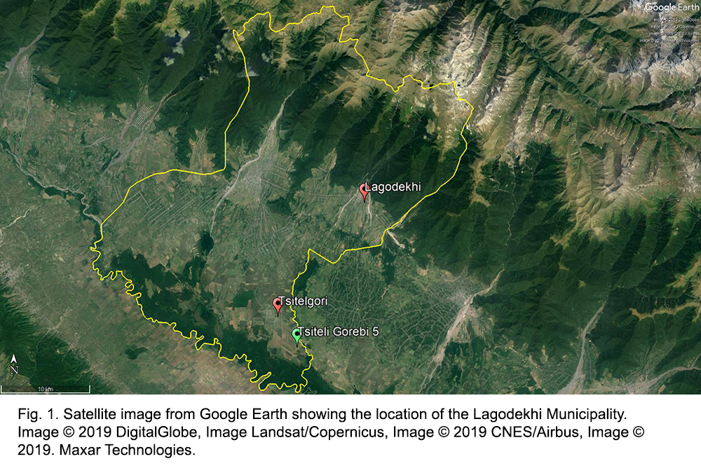
We therefore set out to undertake intensive survey in several different environmental zones, with the aim of better understanding patterns of settlement and land use by geographical area. We hoped to be able to document low-level sites with subtle topography and artefact scatters due to the improved ground visibility. Our efforts focused on three key areas (see Fig. 1):
1) Within approximately one kilometre of Tsiteli Gorebi 5 in the low-lying Alazani River Valley:
2) Immediately north of the village of Ulianovka;
3) In the lower foothills of the Caucasus above the village of Kveda Pona.
Within areas (1) and (2) we undertook transect survey. Individuals were spaced approximately 10 m apart, and each transect was divided into 50 m segments. Within each 50 m long segment, we collected all visible surface artefacts. This resulted in collection areas of approximately 50 m x 80 m.
In area (3), due to the frequency of dense woodland and gullies (which run roughly north-south and dissect the gently sloping upland areas), it was difficult to employ a traditional transect methodology. Instead, we utilised a topographically informed survey methodology in which individuals spaced approximately 10 m apart covered the accessible landforms and recorded any sites or finds as waypoints (WP) with a GPS.
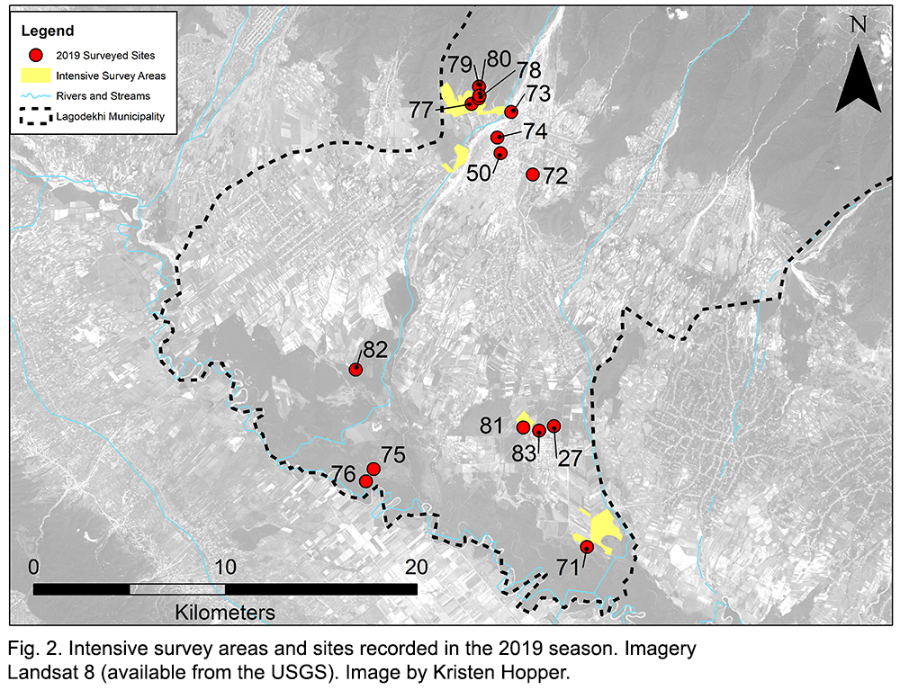
We also aimed to visit several locations identified as possible archaeological sites in our desk-based assessments. Fig. 2 illustrates the three intensive survey areas, and the sites located, or revisited in the 2019 season.