Geoarchaeological fieldwork during the 2019 GILAP expedition focussed on two main points:
1) The geological and geomorphological survey of the areas neighbouring the excavation site of Tsiteli Gorebi 5 (TSG5) and nearby sites, aimed at reconstructing the landscape settled by the Chalcolithic people.
2) contextual stratigraphic and sedimentologic examination of the excavation areas, in order to extract information about site formation processes, area use, and settlement catchment.
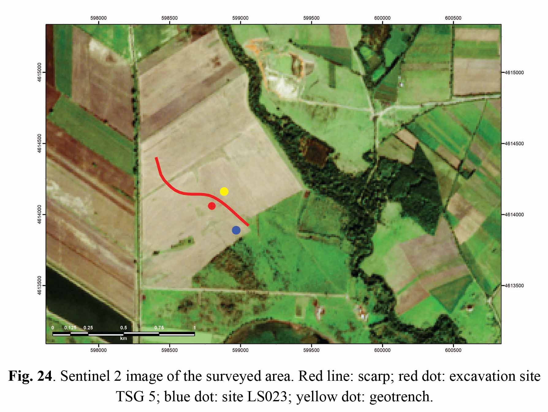
This survey put into evidence a scarp, about 2 m high, rather smooth due to agricultural reworking, which probably represents the western bank of the maximum flood area of the river Kviriatskhali. This scarp runs few tens of metres east of TSG5 and of site LS023, which is another high spot – also yielding archaeological remains – situated about 250 m SSE of TSG5. The two sites represent topographic maxima of the area west of the scarp (i.e. outside the maximum flood area), which is largely flat and subhorizontal, representing a terrace of the river. North of TSG5 the scarp turns smoothly westwards and becomes somewhat lower, until it disappears in a low area characterised by small depressions limited by minor topographic highs.
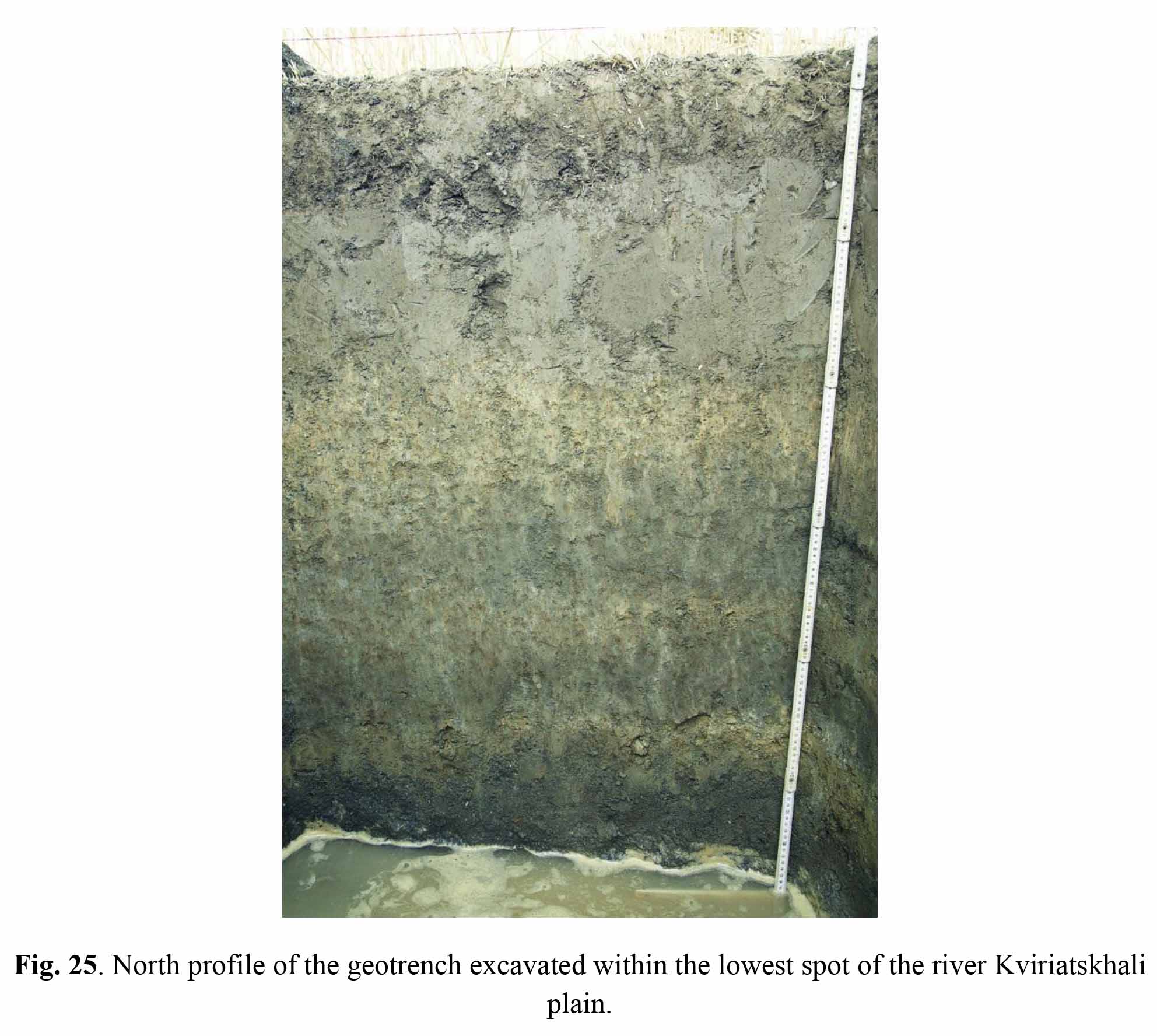
An explorative sondage excavated in the maximum flood area E of TSG5 found the water table at -1.40 m (Fig. 25). The sediments put into light are mostly fluvial, including a fining-upwards layer of coarse/fine grey sand at the base of the observed sequence, overlain by alternating greyish and yellowish silty clay loam with reddish redoximorphic features. The sequence is closed by a dark brown clay layer, very compact and homogeneous. It is worth noting that this sequence resembles rather closely what was observed in deep sondages excavated within the site area in 2018. The top of the grey sand is at 201.90 m in the sondage, at 202.14 in the 2018 Sounding 1 and at 202.5 in the deep sounding of 2019 in quadrant 100.103d.
The overall morphology of the plain and the almost coinciding heights of the grey sand layer in distinct far away profiles suggest that all grey sand layers can be correlated. Consequently, it can be hypothesised that the yellowish silty clay loam sediment occurring in thick layers in the TSG5 area is the remain of a relatively old river sediment that was removed by erosion east of the scarp. At present, the age of this erosional process cannot be ascertained; however, excavation at TGS5 in the scarp area may indicate whether the site develops on it, or if the scarp itself marks an erosional limit of the settlement.
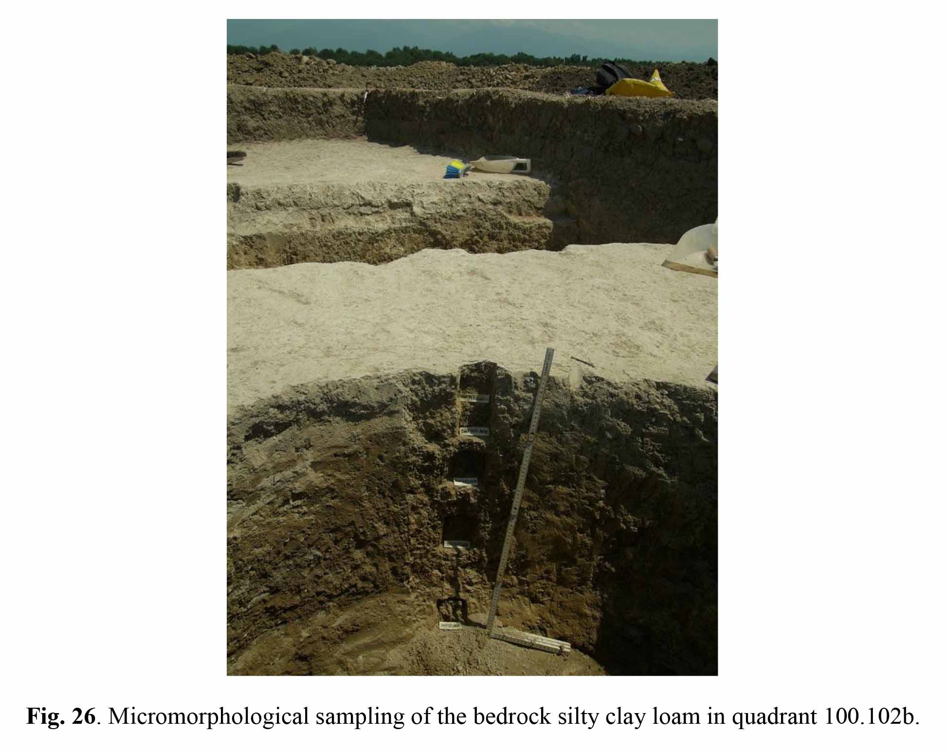
Excavation area observations and sampling Micromorphological sampling (Fig. 26) was carried out in various areas of the site with the following purposes. 1) ascertaining the nature of the walls put into light in quadrant 100.102b. Possible organic or specific mineral component used in preparing the silty loam mixture used for making the walls are expected to appear in thin section. To this purpose, reference samples of the natural yellowish silty clay loam bedrock – possibly used as raw material – were systematically collected along a profile in area 100.103d, where the natural sediment and soil sequence is well represented. 2) verifying whether the top of he natural bedrock sequence was in some way modified by human activities. The aforementioned systematic sampling of the bedrock will be used also for this purpose.
3) assessing the nature of the layered infilling found in a long and narrow ditch occurring in quadrant 100.103d. The base of the infill is layered, with brownish loamy layers including fragments of the substrate, and dark brown clayey layers, whose alternating pattern suggest cyclical process of infill caused by moderate-energy events followed by slow deposition of clay in still environment. Micromorphological observations should put into evidence the nature of the infilling processes. On the other hand, the sedimented material may suggest the nature of the activities that were carried out in the site.