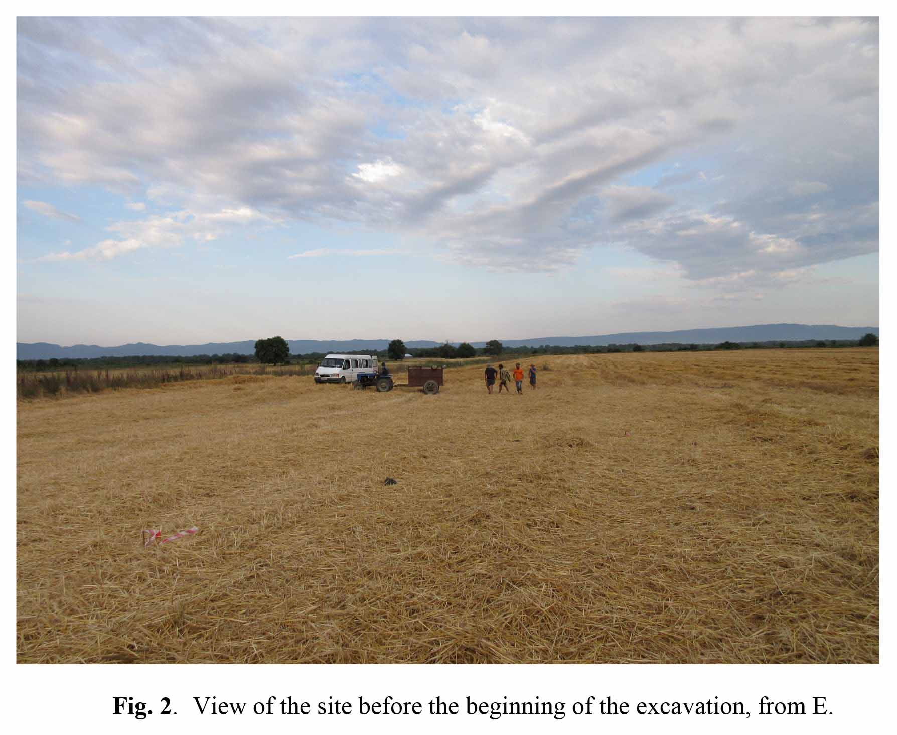
It consists of a low mounded area oriented NE-SW, which has a maximum extension of ca 2 ha and emerges of ca 1.30 m on the surrounding plain. Until post-World War II times the surrounding territory had been occupied by riverine forest. This was cleared in the 1950s, when the whole area was levelled in order to make place for intensive cultivation of both cereals and fruit trees. The site is presently occupied by a large wheat field (Fig. 2). It has been subjected to repeated ploughing, which probably flattened its top and spread archaeological materials over the surrounding area.
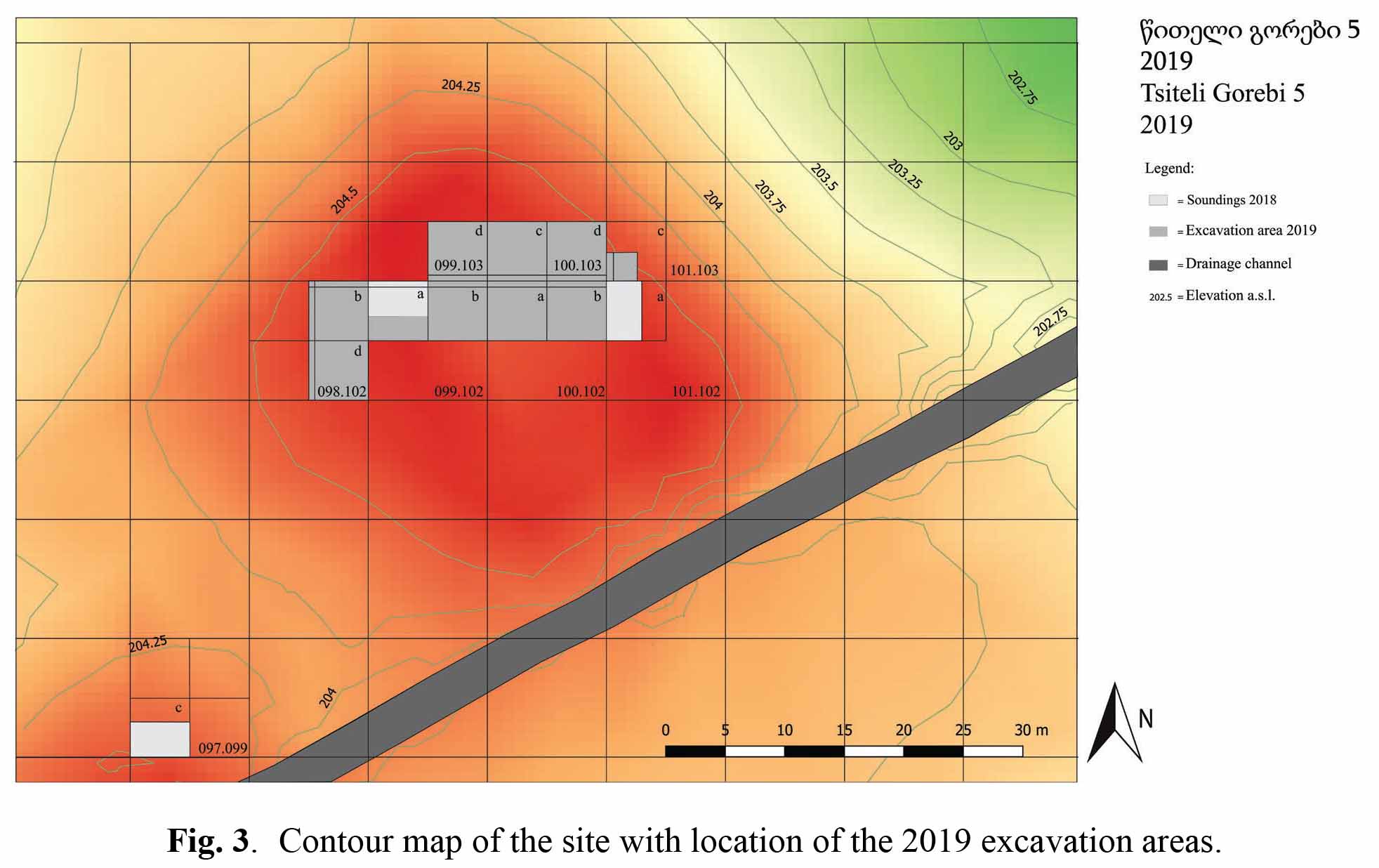
It is characterised by two low elevations, a larger one to the NE and a smaller one to the SW, separated by a 20 m wide slightly depressed area (Fig. 3). A modern drainage channel running SW-NE cuts the site's southern part. The area located beyond the channel is flatter, probably because it has been more affected by ploughing.
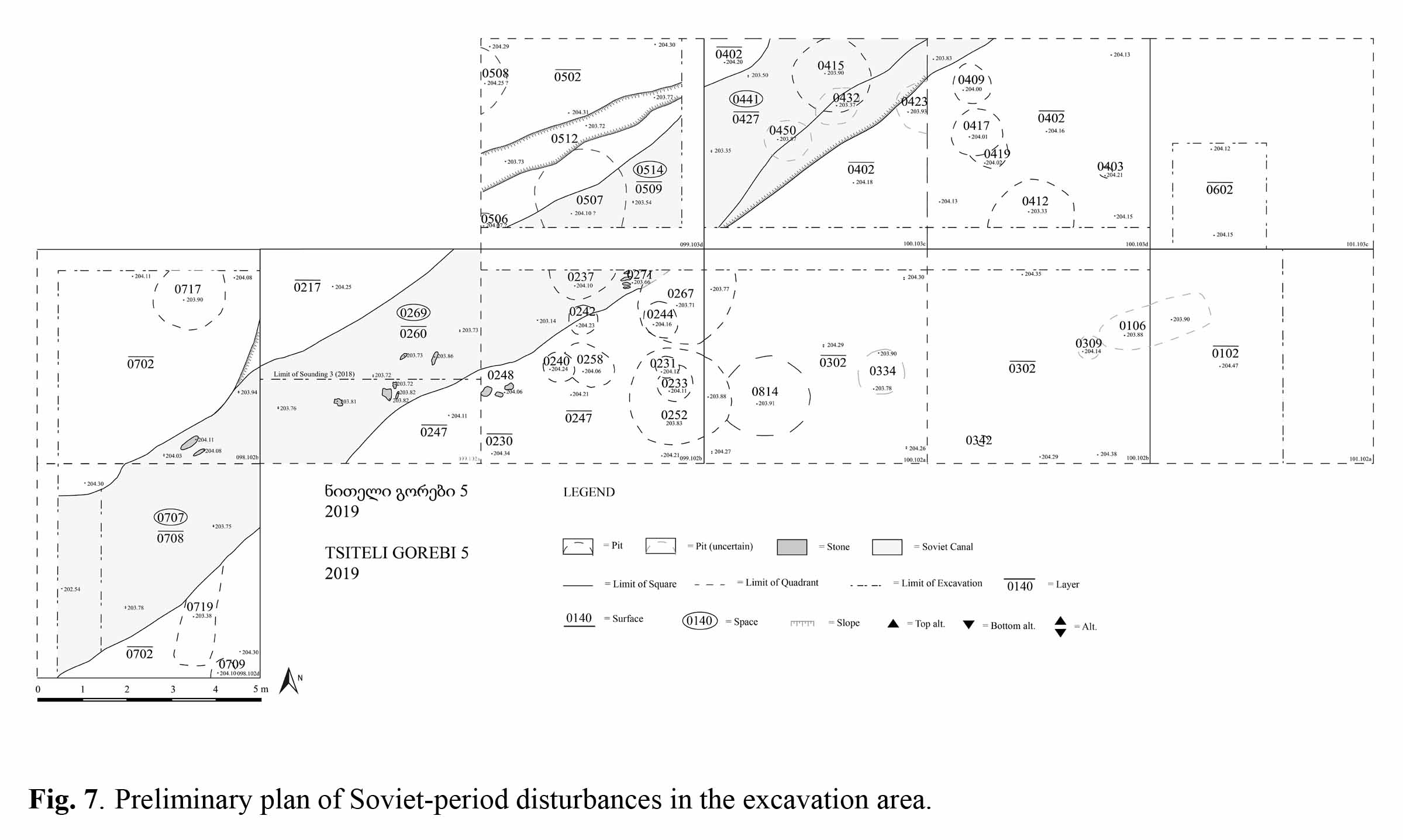
At the beginning of our activities, the wheat field had just been harvested. After removing the wheat stubble, we opened a total of nine 5 x 5 m quadrants (098.102b-d, 099.102a-b, 100.102a-b, 099.103d, 100.103c-d) on top of the north-eastern elevation with the aim of connecting to each other the areas of Soundings 2 and 3 excavated in 2018, both of which had yielded parts of large architectural structures (rectilinear walls in Sounding 2, a large “platform” in Sounding 3) whose function had not been clarified. By obtaining a larger horizontal exposure, we hoped to be able to obtain an intelligible plan of these structures and to get a more precise idea of their general layout and function. A further 2 x 2 m area was opened during the last week of excavation in quadrant 101.103c in order to follow the continuation of the structures uncovered at the eastern limit of the excavation area. The 2019 excavation confirmed and better defined the general stratigraphy of this part of the site, and allowed us to correct some errors of interpretation.
Recent plough soil was only 20-30 cm thick in the eastern part of the excavated area (quadrants 100.103c-d, 100.102a-b), where it was directly underlain by the damaged top of the Chalcolithic level (subsurface layer, up to ca 25 cm thick). Faint traces of SW-NE oriented plough furrows were still visible on top of the latter.
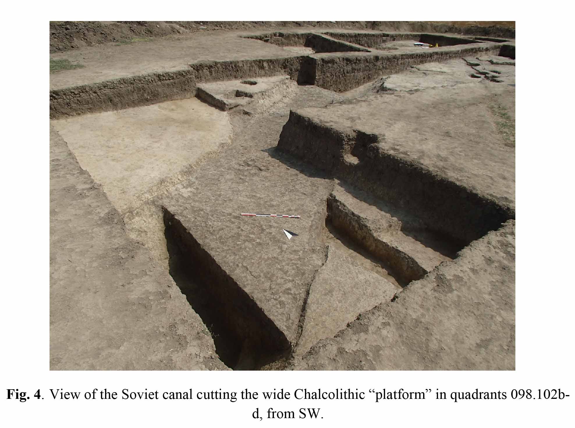
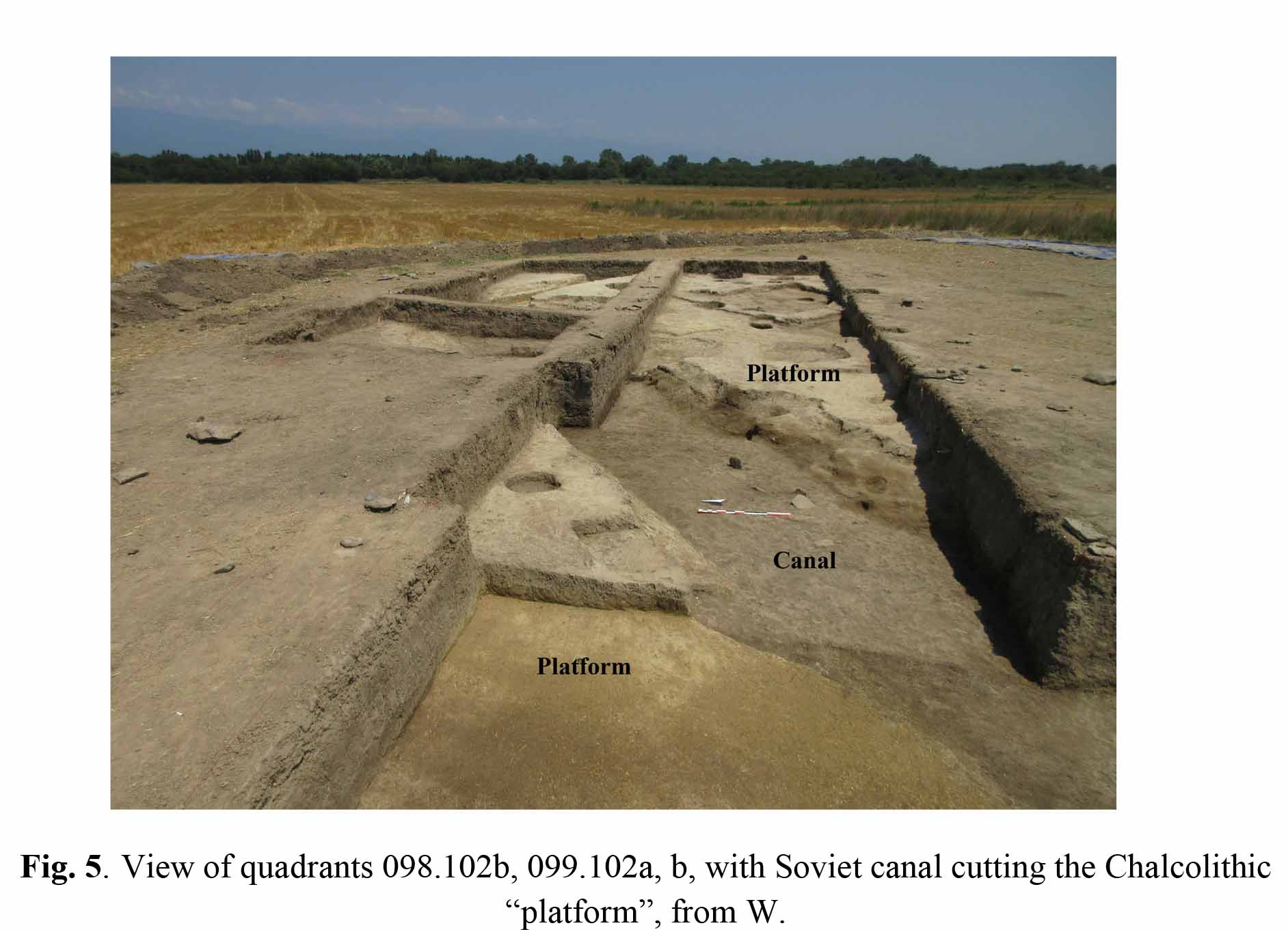
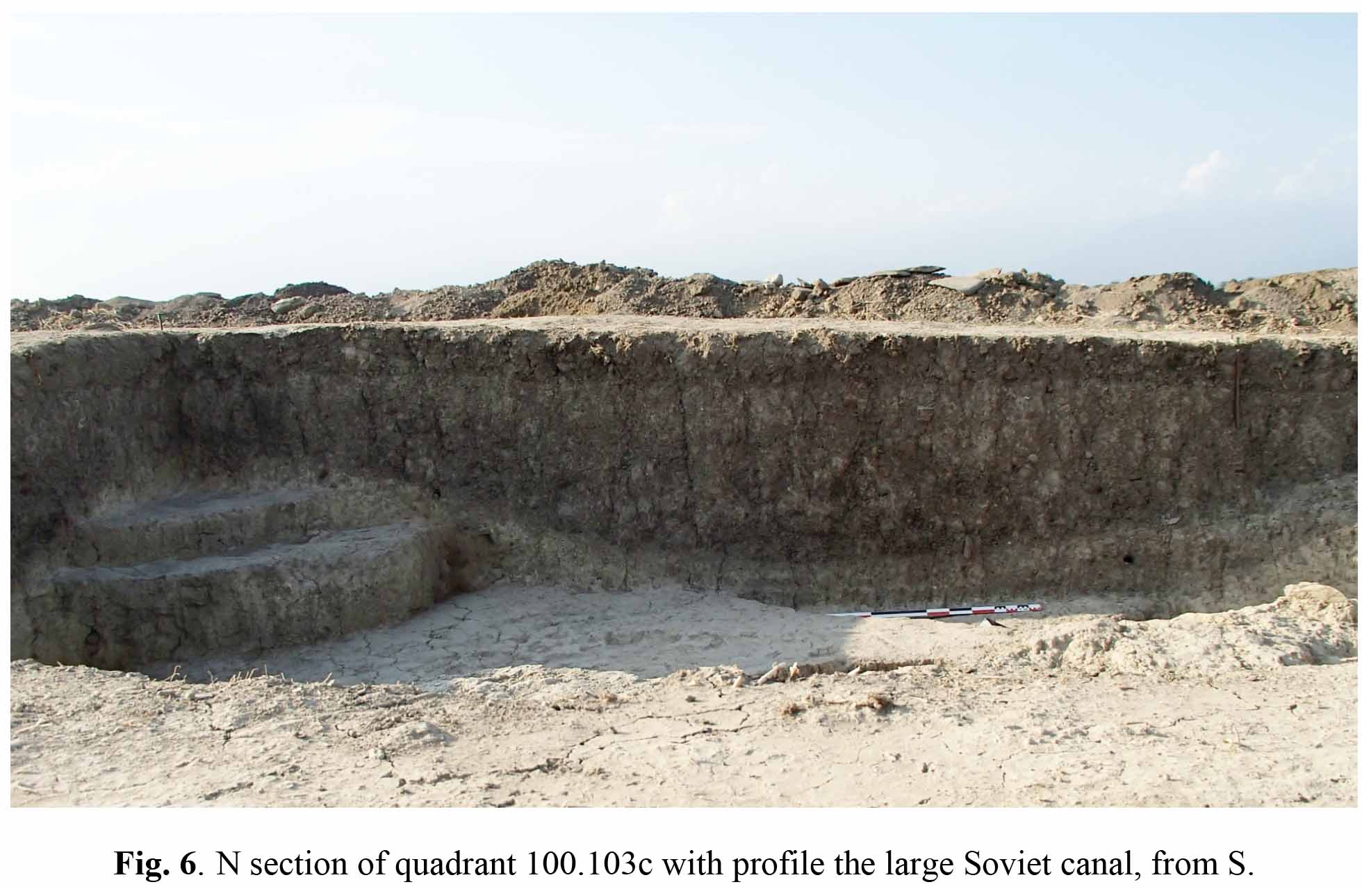
As far as one moved in western direction (quadrants 099.102a-b, 098.102b-d), the recent plough soil was underlain by a progressively thicker layer of greyish amorphous coarse-grained sediments topped by a thinner layer of yellowish soil. In the course of the excavation it became clear that this situation, which had already been observed in 2018 in Sounding 3 and had not been fully understood at that time, derived from the recent deposition of sediments after the in-filling of a ca 270-280 cm wide and 130 cm deep Soviet-period rectilinear irrigation/drainage canal (locus 0441-0269-0707, 0509) which crossed the whole excavation area in SW-NE direction (Fig. 4, Fig. 5), the course of which was followed for 22.50 metres. The canal presently exhibits an U-shaped profile, which derives from the erosion and partial collapse of its sides (Fig. 6). It had obviously been filled during a single operation – its filling did not show any internal stratification – with sediments which mainly derived from flattening the top of the ancient settlement. In fact, in addition to few modern items (a plastic comb, some iron nails and some fragments of iron wire) which undoubtedly prove its modern date, it contained almost exclusively Chalcolithic material. The canal’s filling also contained a few stones and small sparse blocks of clayish material, possibly deriving from the debris of ancient architecture.
It also became clear in the course of the excavation that what we had discovered in Sounding 3 in 2018 and considered to be the western face of a large platform (locus 0224) was in fact the eastern limit of the Soviet canal that had cut into a vast raised area, mainly consisting of compact silty soil of yellowish colour but also containing remains of mud-bricks and showing some internal stratification. The level of the preserved top of this structure varied between 204.11 and 203.90 m a.s.l., but its remains were visible in section up to alt. 204.20. It extends over most of the excavated area, and its different parts have been separately numbered as loci 0715-0224-0254-0255-0510-0422-0414-0408-0406-0377. We interpret it as a vast partially artificial “platform”, once used as a raised base for buildings and other living structures, with the aim of protecting them from water stagnation and repeated flooding, which must have represented a recurrent problem in this depressed part of the river plain. The exact date of the modern canal is unclear, as it cannot be located on any of the available satellite pictures, but we are inclined to date it late in Soviet times (1970s?) as it cuts at least some other disturbances dating to the same general period (Fig. 7).
These consist of large pits of two different shapes: rounded pits with a diameter between 1.50 and 2.50 m, which we tentatively connect with either the eradication or planting of large trees, and rectangular elongated ones, ca 1 m wide, whose aim is less clear. Similar pits, which also occasionally contain modern material (sherds of glass bottles, iron nails) have been found over the whole excavated area, but they luckily affect its south-eastern part (quadrants 100.102a-b) only to a limited degree. It is possible that a few of the many smaller pits which cut the subsurface soil in this area are modern as well but, since none of them contained any modern material, we are inclined to date most of them to the Chalcolithic period.
We were informed by local residents that until the 1950s the area was occupied by riverine forest, which was then cleared and drained in order to make place for fruit tree orchards (an operation with which the large pits may possibly be connected) and other cultivations, and later converted into grain fields, the shape and orientation of which were repeatedly modified in the course of time. Further analysis of satellite images taken in different years and archival research, which we are planning in the future in connection with the Lagodekhi Municipality survey may shed further light on the question of the deep anthropic modifications which affected this part of the Alazani plain in the course of the last 70 years and on their impact on the preservation of the archaeological remains.
In the western part of the excavation (quadrants 098.102b-d, 099.102a-b, 099.103d) nothing was preserved of the Chalcolithic structures once standing on top of the raised area, with the exception of few unintelligible traces of possible walls and living surfaces at the eastern limit of quadrant 099.102b (Fig. 8, Fig. 9). We therefore exposed the top of the ancient raised area (“platform”) and emptied the modern pits which cut it, but excavated only the upper part (for a maximum depth of 40 cm) of the filling of the modern canal over its whole course.
Although this allowed us to collect a significant amount of Chalcolithic material, the latter was extremely homogeneous, and we considered that emptying the whole canal would not have increased its representativeness for typological studies. We therefore limited ourselves to excavate two soundings until the bottom of the canal (respectively in the north-western part of quadrant 099.102b and along the western limit of quadrant 098.102d) in order to measure its depth and determine its profile before abandoning this section of the excavation.
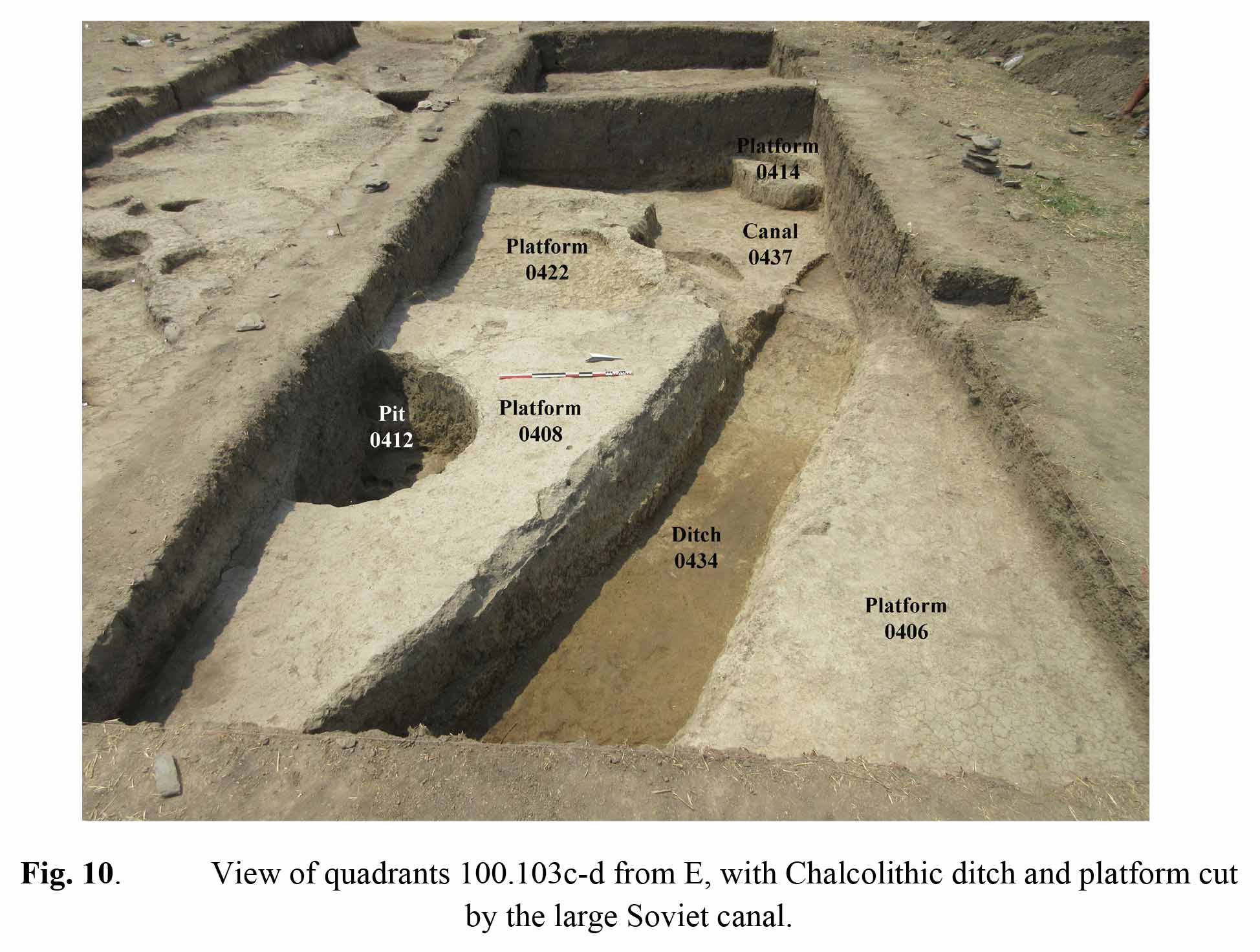
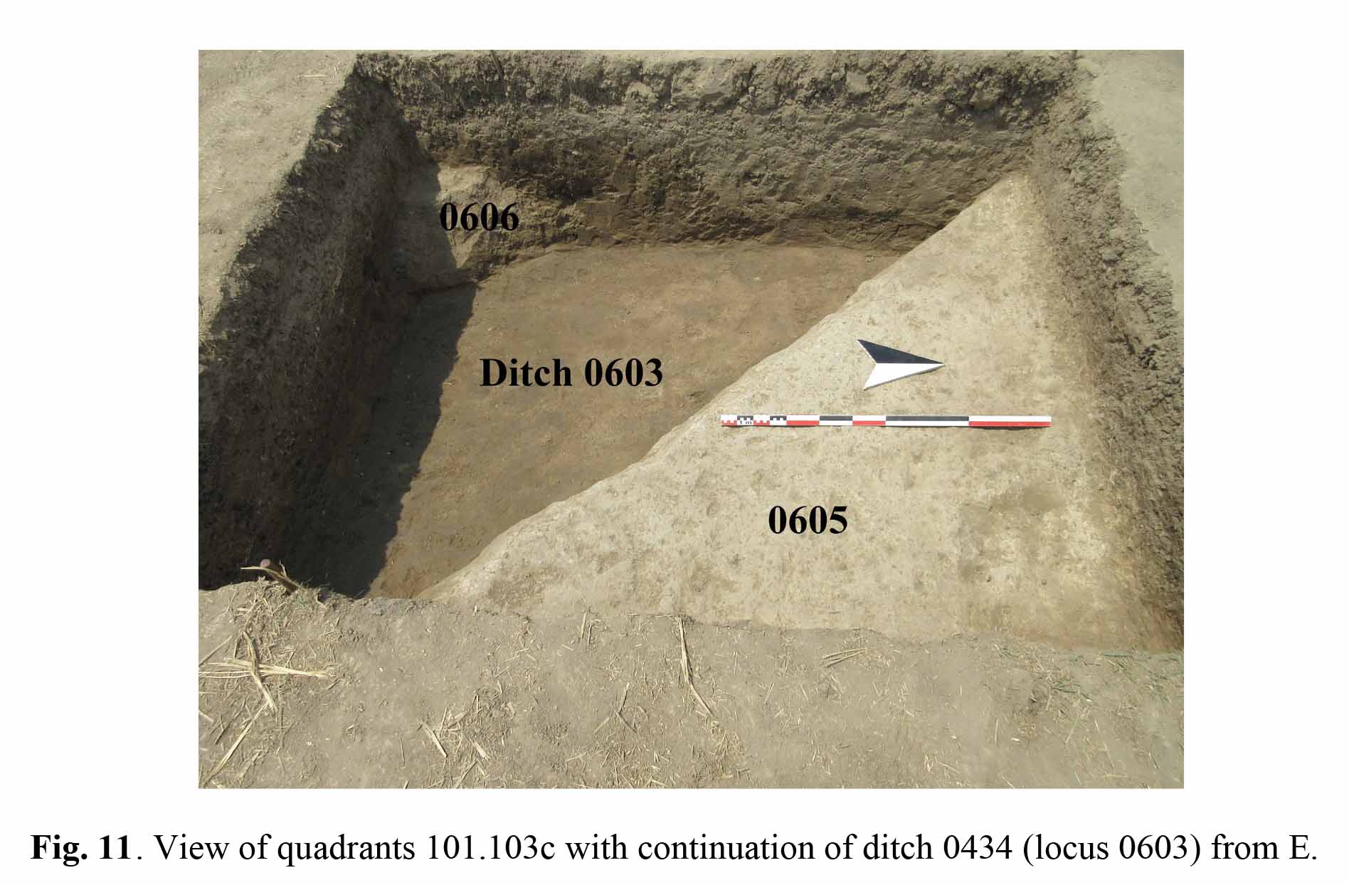
More interesting results were reached in the north-eastern part of the excavation area. Here, in quadrants 100.103c-d, we discovered a Chalcolithic ditch (locus 0434) oriented SE-NW dividing two sections of the raised platform (loci 0408-0422-0414 and respectively 0406) (Fig. 10), the NW limit of which had been cut by the above-mentioned Soviet canal. The ditch continued as locus 0603 in adjacent quadrant 101.103c (Fig. 11), after making a slight curve at the limit between the two quadrants; its course could be excavated for a total length of 8.30 metres.
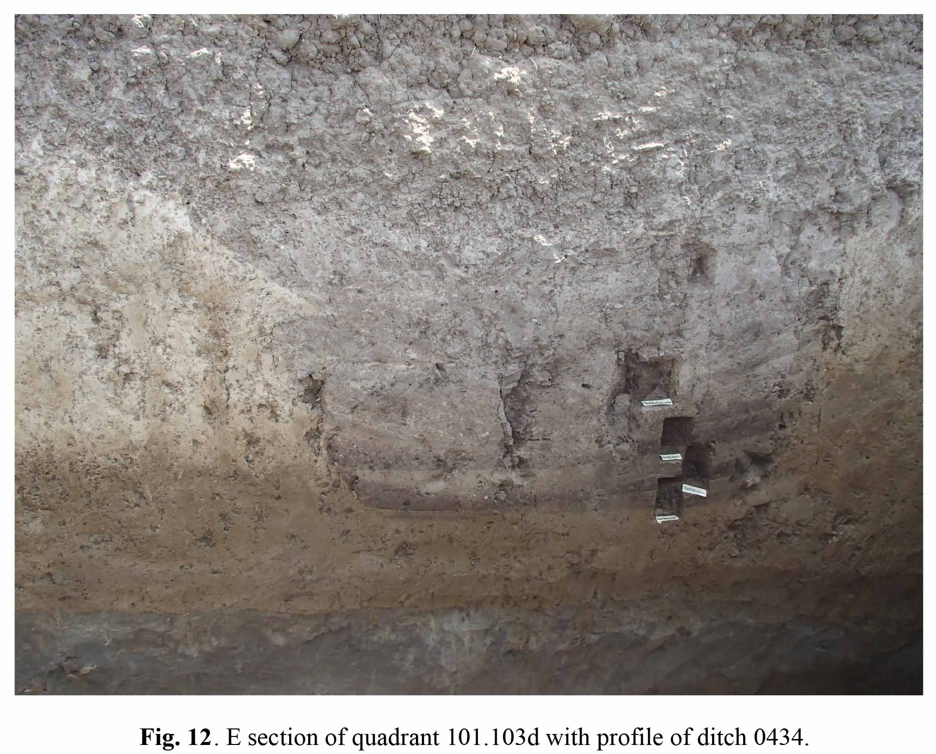
As preserved, ditch 0434-0603 was 0.78 m deep, only slightly sloping in NW direction (its bottom lay at alt. 203.38 at the eastern limit of quadrant 100.103d). Its width was 1.70 m on the top and 1.0 m near the bottom, which had a slightly curved profile (Fig. 12). The sides were irregular and had been smoothed by erosion and affected by partial collapse. Its filling was layered and composed of sediments of greyish colour, which suggests successive events of slow deposition of clay in still environment (loci 0407, 0425, 0426 and 0435). It contained small quantities of material of exclusively Chalcolithic date. As can be observed in section, the ditch had been cut into a thick compact layer of dark yellowish silty clay loam of natural origin (locus 0440).
Sediments deriving from the excavation of the ditch had then been accumulated on both sides of it, in order to create the raised limits of the “platforms”, the upper parts of which were composed by the same sediments found on the bottom, and contained almost no material of anthropic origin.
Ditches, the purpose of which remains to a certain extent unclear, are rather common in different settlements of the Neolithic period both in Georgia (Arukhlo) and in Azerbaijan (Kamiltepe) but have also been found at Damtsvari Gora which like Tsiteli Gorebi 5 is dated to the Chalcolithic period and lies at a distance of only a few km from it (see Ioseliani in B. Helwing et al. The Kura Projects. New Research on the Later Prehistory of the Southern Caucasus, Archäologie in Iran und Turan 16, Berlin: Dietrich Reimer Verlag 2017, 223-231). Considering the profile of ditch 0434, the nature if its fillings, and the composition of the “platforms” of both sides of it, we suppose that its main purpose was to isolate the raised areas of the settlement and protect them from stagnation of water from the heavy rainstorms which characterise the region and from occasional flooding of the river plain.
Of the two raised areas (loci 0408-0442-0414 and 0406) located on the sides of ditch 0434, only the former had preserved some faint traces of the walls originally lying on top of it, but unfortunately the presence of a large modern pit (locus 0412) prevented us from tracing their exact limits. During the last days of excavation, a 1.0 m wide sounding was cut at the eastern limit of quadrant 100.103d into the natural soil. This put into evidence the presence, under locus 0440, of a sequence of layers of alluvial origin similar to that excavated in 2018 in Sounding 1 and, in 2019, in the geological trench on the plain to the east of the site (see below). The sounding also highlighted the presence of two pits (loci 0436 and 0438) filled with grey sediments containing little Chalcolithic material, which cut “platforms” 0406 and respectively 0408. They had clearly been dug from the top of the platform into its body and the underlying natural soil, in spite of the fact that their cuts could not be identified on the platform’s surface, probably because they were of roundish shape with a small opening on top and progressively widening sides.
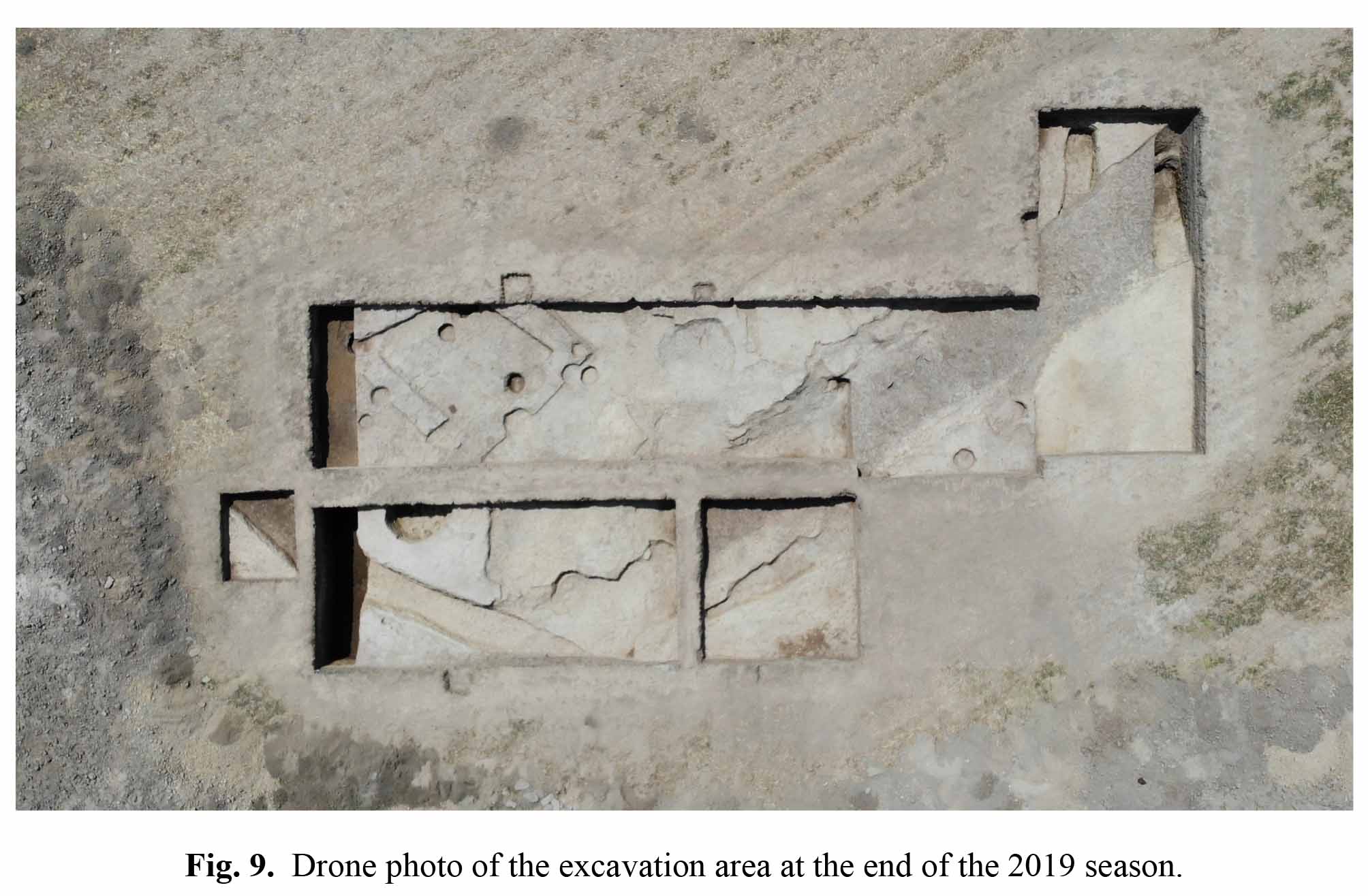
As we anticipated, the only part of the excavation where some remains of Chalcolithic architecture could be identified corresponds to quadrants 100.102a-b at its south-eastern limit, on the continuation of Sounding 2 of 2018, which had already yielded similar remains. The continuation of the large raised “platform” (locus 0377) appears to have been deepened in this area, at some points almost down to the bottom of the thick yellow layer which represents its base, in order to accommodate the walls of some buildings. This circumstance apparently partially spared the Chalcolithic structures in this area from the effects of ploughing, a fact which allowed us to follow the line of some walls. Unfortunately, these were not well preserved (their maximum height was generally less than 10 cm and their body was very deteriorated). Additionally, the area was cut by a large number of small pits, whose diameter varied from 0.50 to 0.90 m. Most of these pits were visible just under the bottom of the surface soil layer. Since they contained only Chalcolithic material, we suppose that most of them had originally been dug from a later Chalcolithic layer, which had completely disappeared (this had been considered as Level 1 in the 2018 excavation of Sounding 2).
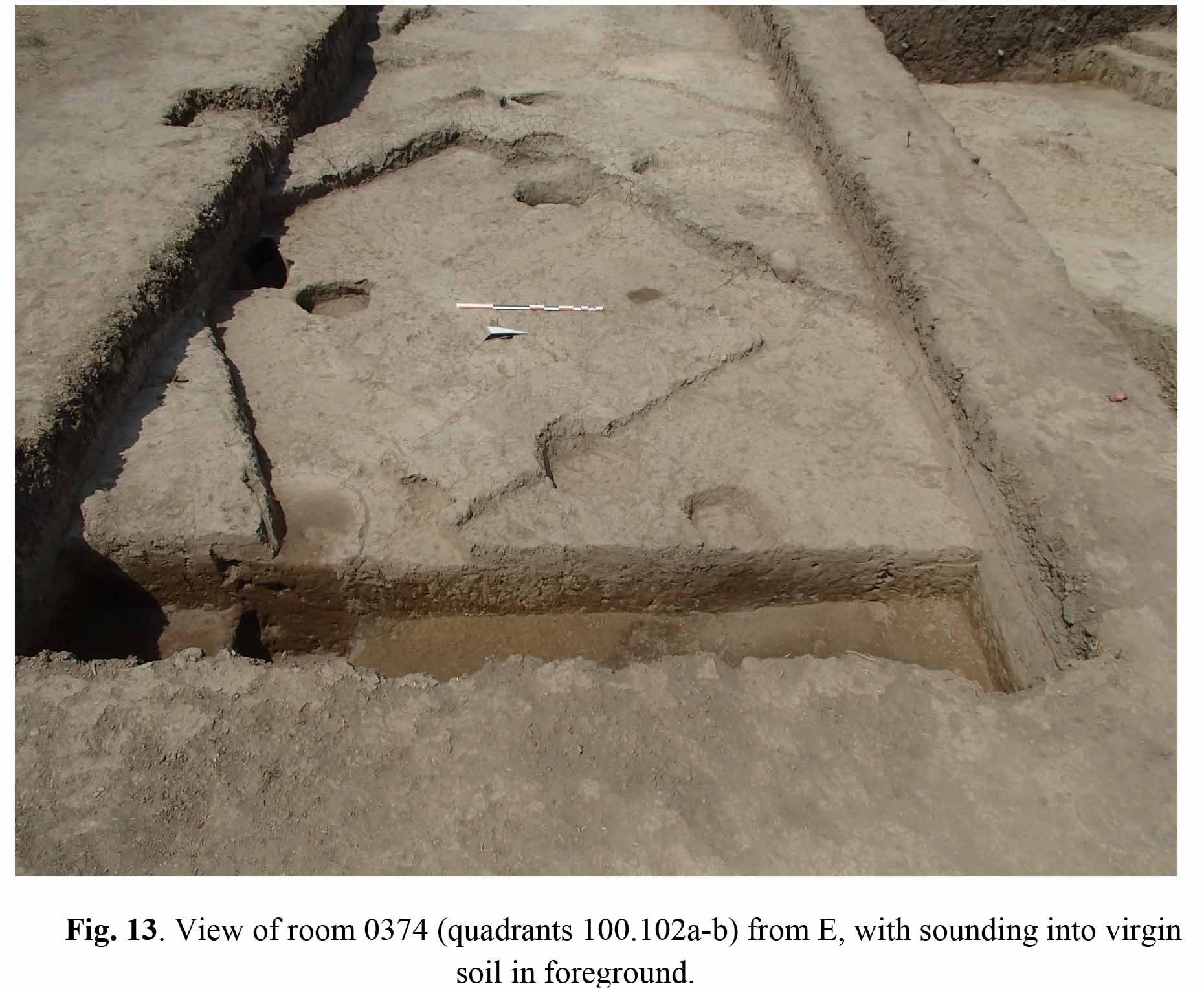
The Chalcolithic structures uncovered in this area (Fig. 13) represent the continuation of the walls discovered in 2018 in Sounding 2, which had at that time attributed to “Level 2”. We were able to draw the tentative plan of a complete building. This was oriented SW-NE, and had rectilinear walls,on some of which we observed what seemed to be the limits of rectangular-shaped mud-bricks. It apparently consisted of two main rooms, the second, smaller one of which (locus 0374) was accessed from the first one through a sort of corridor.
Room 0374 was located half way between quadrants 100.102a and 100.102b. Its limits were walls 0347 (NW), 0363 (NE), 0388 (SE) and 0346 (SW), whose width varied between 0.60 and 0.90 m. Remains of an irregular white-plastered floor (locus 0371) sloping in a SE direction from alt. 203.97 to alt. 203.86, were observed in different parts of the room, but no in situ material was recovered on this floor and even the overlying filling (locus 0333) contained very few artefacts.
Besides room 0374, the remains of other contemporary structures were also observed. Wall 0331, ca 1.0 m wide and possibly flanked by a lower bench (0357), was situated to the west of wall 0347 at a distance of ca 2.0 m from it. It may have belonged to another room which continued in quadrant 099.102b, but had been almost completely obliterated by erosion and modern pits. It was separated from 0347 by a street-like open area (space 0375) whose walking surface was the top of the “platform” (locus 0377 in this part of the excavation).
Wall 0366, which run in SW-NE direction in the south-eastern corner of quadrant 100.102b was the continuation of wall 0132 discovered last year in Sounding 2. As excavated, its orientation seems to be slightly different from that of the walls of room 0374, but it probably originally belonged to the same building, whose limit may have lain close to the continuation of ditch 0434-0603 and have approximately followed its curve.
A 1.0 m wide sounding excavated during the last days of the excavation along the eastern limit of quadrant 100.102b resulted in the discovery of parts of two walls (0389 and 0393) of an earlier phase of Level 2, which run roughly parallel to each other in SW-NE direction and lay on the continuation of similar walls (0146) discovered in Sounding 2 at the end of the 2018 season. Unfortunately, these walls were also preserved for a height of no more than 20 cm. A series of laminated surfaces (locus 0394, alt. 203.90-85) was associated with them, as it joined the base of wall 0393. Walls 0389 and 0393 and surface 0394 were lying directly on the natural soil (locus 0801). This corresponds to the base of the thick compact layer of dark yellowish silty clay 0440, which in this part of the excavation had probably been cut into by the first inhabitant of the site before erecting their first buildings on it. Surface 0394 and the fillings overlying it were extremely poor in finds of anthropic origin, though not completely devoid of them. They were cut by two pits (0806 and 0808) filled with grey sediments, which deepened into the natural soil and where similar in shape to pits 0436 and 0438 in quadrant 100.103d. Like the latter, their top had not been noticed in the course of the excavation, but we suppose they had been dug from the level of the top of the “platform”.
To conclude, the large-scale excavation of 2019 confirmed that the ancient occupation at Tsiteli Gorebi 5 is exclusively of Chalcolithic date, and that it dates to a single chronological period, though with two, or maybe even three different sub-phases, which are most probably very near to each other in time. The depth of the anthropic occupation amounts to no more than 1.30 m, including the ditches and pits dug into the natural soil, but is reduced to a maximum of 60 cm if only building layers are considered. Furthermore, the upper part of the latter has been deeply affected by a combination of different post-depositional elements (water stagnation, unfavourable soil conditions, pervasive bio-perturbance – animal burrows – and especially modern disturbances and deep ploughing) which caused irreversible degradation of the architectural structures once standing on top of it, and the dislocation of artefacts from their original position. In spite of these unfavourable circumstances, it confirmed beyond doubt the presence of rectilinear mud-brick (?) architecture with wall of significant width, which represents until now an unicum in the contemporary cultures of the Southern Caucasus, and provided a general idea of the general layout of the ancient settlement, which appears to have been founded on slightly elevated areas emerging from the alluvial plain, the height of which had been artificially increased by digging ditches between or around them.