Drs. Matteo Massironi, Giovanni Monegato and Stefano Furlani completed the geological survey of the area surrounding the site of Aradetis Orgora, which had been started during the previous campaigns.
The site is situated near the junction of the rivers Kura, Eastern Prone and Western Prone. In particular, it is located on a mound isolated from the surrounding river terraces, which are presently delimited by the course of the Western Prone river, and by two deep incisions oriented in N-S and E-NE directions. The first of them represents the Eastern limit of the site, and is presently not occupied by any water course, while the second one, on its northern site, is occupied by a small stream, which originates from a number of small springs situated along the above-mentioned paleo-incision.
During the 2103 season, the site and the surrounding area have been the object of a survey, which allowed to establish the stratigraphy of the outcropping succession. A detailed analysis was also performed on the open trench for the new highway located ca 500 m to the NW of the site. A useful exchange of data and information took place with the team of geologists from Ilia State University of Tbilisi, who provided us with high-resolution seismic profiles of the site and detailed DTM. Finally, explorative surveys in adjacent areas were also performed, as well as statistical counting of the pebbles from the present neighbouring rivers (Kura, Western Prone, Eastern Prone e Liakhvi), in order to compare these deposits with the sandy and pebbly layers outcropping at the site and in its immediate surroundings.
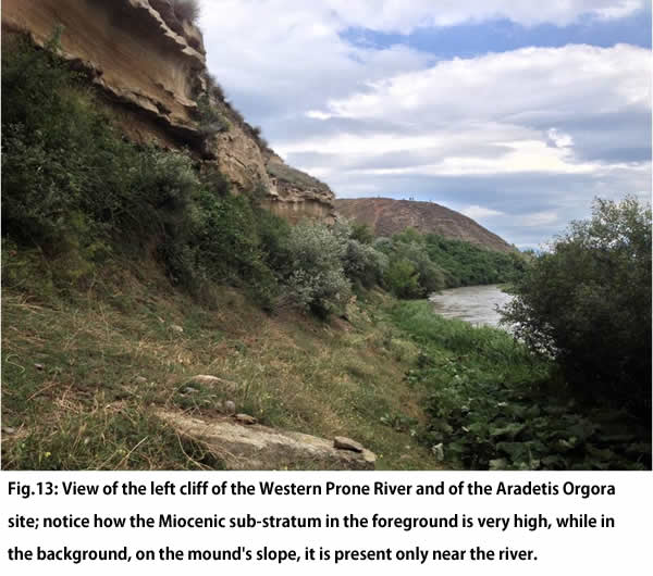
The analyses have highlighted the presence of a quite complex geological history of the area which, due to intense tectonic activity, witnessed to significant phenomena of river migration during the late Quaternary. At the site in particular (Fig.13), petrographic analysis has shown that the gravel body on which the ancient settlement was founded belongs to the Liakhvi river. These deposits lie on a sandstone substratum ascribed to the Miocene. A similar sedimentary body crops out in the terrace located to the East and on the top of the terrace located to the NW of the site. The stratigraphy of the latter terrace is more complex, due to the presence of a fault corresponding to the location of the ENE-WSW incision, which is responsible for a ca 5 m displacement of the Miocene sandstones in comparison with those at the base of the Aradetis Orgora main mound. The Miocene sandstones of the NW terrace are overlain by ca 5 m of gravels, the composition of which is comparable with those from the Western Prone River, and by ca 1.5-2 m of light-coloured carbonate silt, inside which deformed fossilised roots have been found. The sequence is closed by the Liakhvi river gravel body.
In the highway trench the gravel body of the NW terrace is only 2 m thick in the S portion, but its thickness increases significantly moving toward the N along the trench, where it reaches a maximum depth of 10 m. The gravel unit of the terrace can be attributed to the Western Prone River. The presence of a well developed soil with a calcic horizon on the surface indicates that the age of these deposits is almost certainly older than that of the fluvial units outcropping at the Aradetis Orgora site.
Structural analysis confirmed the presence of the above mentioned fault near the site (this is also visible in the seismic profiles by the Ilia S.U. team) and, along the highway trench, of a number of deformations both in the Miocene units and in the Quaternary deposits. As indicated by the direction and geometry of the faults, the deformations observable near the sites can be attributed to the southwards propagation of the front of the Greater Caucasus range. The analysis of surface morphology, thanks to the detailed DTM, showed how the incisions surrounding the site are probably related to the erosion connected to a local ephemeral drainage originating to the N, which must have taken place after the migration of the Liakhvi River to the East, that caused the abandon of this reach.
The difference in elevation between the creek originating from the springs near the site and the present course of the Western Prone is mostly due to fault displacement. It is therefore to be excluded that the incisions have been artificially deepened by the ancient site's inhabitants.